17 August 2020
The problem:
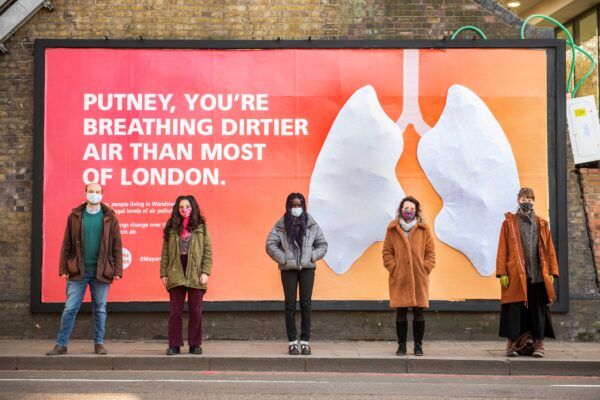
London’s air might seem clear to the naked eye, yet 2 million people there live with illegal levels of air pollution. It accounts for nearly 10 million early deaths and costs the city £3.7 billion every year.
King’s College London research we funded showed living near busy roads can significantly increase chances of stroke or cardiac arrest, or make children’s lungs function poorly.
People increasingly want change. Our 2020 YouGov survey showed that 84% of Londoners want air quality in their area to be improved. Local government is responding to their calls.
An issue this large and complex requires bold and innovative action to protect future generations and ensure our children breathe cleaner, healthier air.”
Sadiq Khan, Mayor of London
But it will not be easy. London needs high-quality, hyperlocal data to mobilise the public, inform smart changes to regulations and encourage businesses to introduce cleaner technologies.
The solution:

We worked with our grantee the Environmental Defense Fund Europe (EDFE) to establish Breathe London. Its state of the art monitoring technology gathers air pollution data at the street level where Londoners live, work and play.
A network of 100+ lower-cost sensor pods positioned throughout the city transmit real-time air quality measurements, with several located near vulnerable groups at schools and hospitals. Breathe London also uses Google Street View cars for mobile monitoring, and wearable sensors to map air pollution on children’s school run. The programme is now helping other cities to replicate and refine its successes. Watch the video for more:
All of the data is published for free on Breathe London’s website, and searchable via an interactive map.
Six months later, we joined a panel to launch The Breathe London Blueprint which shares insights on how to deploy small sensors and innovative air quality technology at the city scale.
The Impact:
As the timeline below shows, this approach has helped transform London’s capacity to tackle air pollution, and provided a platform and mandate for concerted political action.
2018
- Aug: Google Street View cars begin daily sampling of pollution on London roads
- Sept: Building begins for world-leading monitoring network across all London boroughs
2019
- Jan: Mayor Sadiq Khan officially launches the static and mobile monitoring project
- Jan: Breathelondon.org launches
- Mar: Sadiq Khan launches wearables monitoring component
- Mar: The Greater London Authority announces funding to expand Breathe London network to include more hospitals
- May: More than 250 children across five schools wear sensors to and from school for five days.
- Jul: Interactive map displaying 100+ monitoring sites across the city added to BreatheLondon.org
- Jul: Project featured on CNN’s Innovative Cities TV show and Reuters TV
- Sept: Breathe London data is used by campaigners to advocate lowering pollution near primary schools and bus garages
- Oct: On-road NO2 data collected by specially-equipped Google Street View cars is added to the Breathe London map and to the new Google Environmental Insights Explorer: Air Quality Lab
- Oct: EDF Europe hosts interactive display of the Breathe website in the “Breathing Space” exhibit at the Science Museum and the Breathe London workshop C40 hosted for global air quality leaders
- Oct: Breathe London’s assessment shows NO2 pollution on busy major roads is on average 50% higher than smaller back roads highlighted by the Mayor
2020
- Jan: Breathe London awarded a Smart 50 award by Smart Cities Connect
- Feb: EDF Europe presents Breathe London learnings at Prospect Magazine’s Clean Air Roundtable
- Feb: ‘Find my location’ button and enhanced search features are added to the Breathe London map
- Apr: Breathe London data is made available for third parties to create apps and services
- Apr: Breathe London partners’ analysis of impact of lockdown on London’s air pollution levels submitted to the UK government and cited in its report on changing pollution levels during lockdown
- Jun: Breathe London represented at the Clear Skies to Clean Air webinar, organised by the Organisation for Economic Co-operation and Development, World Wildlife Fund and EDF Europe, in collaboration with the World Bank. Watch the webinar recording.
- Jul: EDF Europe and environmental charity Global Action Plan release data and surveys showing NO2 pollution fell by up to 50% commuting hotspots during lockdown and Londoners are keen to keep pollution down
2021
- Feb: The Breathe London Blueprint is published. It includes both a guide and technical report, providing lessons and insights to support hyperlocal monitoring in other cities and accelerate clean air action.
Campaigning in the run up to 2021 Mayoral election:
Youth activists, parents and health workers united to demand London mayoral candidates address air pollution inequity through ambitious policy commitments.